Exploration
Geothermal Exploration and Development
 You can’t put a geothermal power plant just anywhere…
Geothermal exploration encompasses a spectrum that starts with “grass roots” identification of prospective geothermal sites, and ends with the drilling of the first successful production well. The objective of an assessment program is to determine the location of the highest enthalpy fluids at their shallowest depth, with adequate permeability to achieve commercially viable production for power generation or direct use.
A well-managed exploration program typically involves several stages, with each successive stage involving greater expenditure while effectively utilizing the data acquired from previous stages. In this way, early-stage exploration risk is mitigated and exploration funding is best directed to the most favorable sites. A typical (simplified) exploration program might consist of the following:
- Phase 1 – Desktop exploration: acquire and compile existing data, and perform a preliminary resource assessment using GIS
- Phase 2 – Early stage exploration: site assessments, geologic mapping, spring and well fluid sampling and analysis, shallow temperature and Geoprobe surveys
- Phase 3 – Intermediate stage exploration: conventional temperature gradient drilling and geophysical survey(s), such as close-spaced gravity and magnetotelluric.
- Phase 4 – Drilling and testing of deeper exploration (discovery) and confirmation wells, together with reservoir analysis
 Phase 1: Desktop Exploration
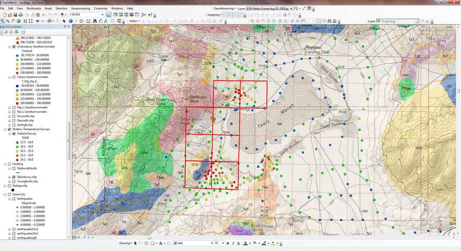
Geographic Information Systems (GIS) allows spatial data to be overlaid and visualized together in multiple ways, enhancing trends and allowing many types of spatial analysis. GIS has been used at the regional scale in the U.S. to identify “blind” geothermal systems. Once potential target areas have been delineated, associated logistical, political, environmental, and social issues can be recognized.
At the project scale, GIS can help determine spatial relationships between various data sets, which helps in understanding subsurface structure and heat flow and thus guide further exploration.
Our GIS staff has many years of experience building custom geothermal GIS databases using both public and field data. In addition, we perform predictive spatial analysis, such as boolean and fuzzy logic models, and weights-of-evidence or logistic regression modeling.
 Phase 2: Early Stage Exploration
GDA provides site assessments to help you understand the geothermal potential of your property. These can include:
- Environmental permitting review
- Structural and geologic mapping
- Geochemical water and gas sampling
- Shallow temperature surveys
- Step-by-step project planning
- Geophysical survey planning and data integration
Our geologists have decades of experience in reconnaissance exploration and assessment, identification and mapping of geothermal manifestations, and successful project management.
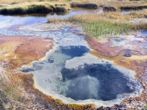
 Shallow Temperature and Geoprobe Surveys
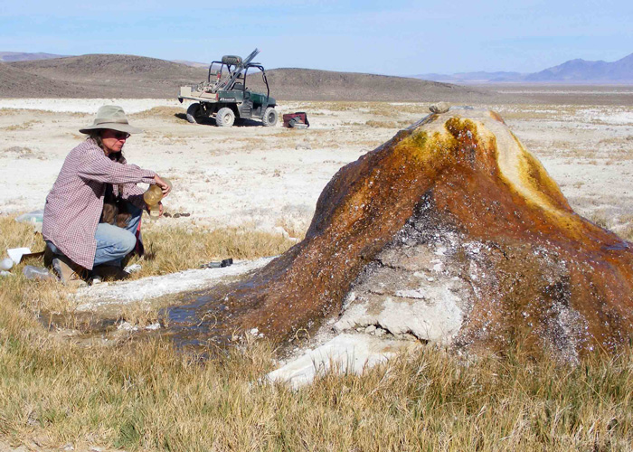
Shallow temperature surveys are a cost-effective tool that can identify and delineate geothermal outflow zones, prior to more expensive temperature gradient hole (TGH) drilling. Both the Geoprobe and 2-meter surveys can significantly reduce the cost of subsequent geophysics and TGH drilling by directing the exploration to a smaller area. The cost of both surveys together are normally less than the cost of a single TG well.
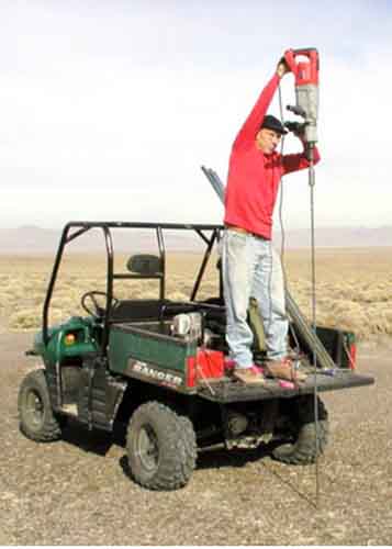
The 2-meter survey method utilizes 2.3m long, 1.4cm diameter hollow steel rods which are pounded into the ground using a demolition hammer. Resistance temperature devices (RTDs) are then inserted into the rods at 2-meter depth and allowed to equilibrate for one hour. The temperatures are then recorded and the rods are pulled out of the ground. The equipment is small enough to fit onto a 4WD ATV, giving it off-road capability. 2-meter surveys work well in areas with loose substrates such as sand, silt, and deep soil. They cannot penetrate cobbles or bedrock.
This technique is very effective in delineating shallow outflow zones and tracing them up to their associated upflow area. GDA has years of experience performing and interpreting these surveys.
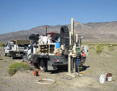 Geoprobes are truck-mounted devices that pound 6cm diameter rods into the ground to depths up to 60 meters (200 feet), without removing soil or rock material and with minimal environmental impact.
A plastic tube is then inserted into the rod such that water samples and bottom-hole temperatures can be taken. Thus, the Geoprobe can be made to function as an inexpensive temperature gradient hole. Up to 8 sites a day can be sampled. Like the 2-meter survey, Geoprobes work best in loose substrate and cannot penetrate bedrock material.
Coolbaugh et al. paper on 2-meter surveys
Zehner et al. paper on 2-meter and Geoprobe surveys
 Phase 3: Intermediate Stage Exploration
As geothermal exploration progresses to the intermediate stage, project work moves increasingly underground in the form of geophysical surveys and drilling programs. Individual studies of this type can run into the hundreds of thousands of dollars, and are usually performed by outsourced specialists. However, Project Geologists are still necessary to understand the bigger picture, manage the various types of work, and guide the project to completion.
GDA personnel have decades of experience in geologic project management. This includes project planning, deciding which program or survey best fits your particular project, coordinating contractors, and ensuring environmental compliance. We know how to do the job right, at least expense to the client.
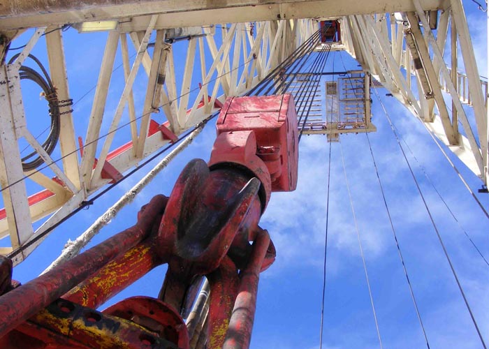
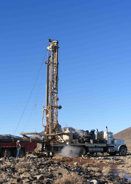
Phase 4: Advanced Stage Exploration
Advanced stage exploration involves the drilling of deep holes designed to penetrate the probable geothermal reservoir, either through a narrow diameter exploration “slim hole” or with a large-diameter production well. Once the well is completed, there are many down-hole tools available to ascertain temperature, pressure, flow rates, and other important variables. These data are then passed on to a reservoir engineer who will use the information to calculate the size and viability of the resource. This, in turn will help power plant engineers to choose the basic design and capacity of the intended power plant. A comprehensive due diligence of the non-geothermal aspects of the intended project should be of the highest priority to the developer prior to entering the later geothermal exploration phases.
GDA’s geologic and engineering teams work together to understand and develop your geothermal resource, and can site a power plant of the right size and design to provide decades of renewable power.